

The Site
![[ LAM Visitors\' Centre ]](../../images/site/164743_2.jpg "[ LAM Visitors\' Centre ]")
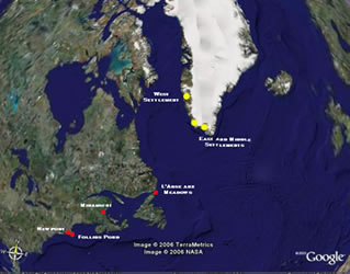
LAM Visitors\' Centre, After the completion of the Ingstad excavations in 1968, the historical significance of the L'Anse aux Meadows site was recognized by the Historic Sites and Monuments Board of Canada, and in 1975 a Federal-Provincial agreement was signed to make it a National Historic Site of Canada. All such sites are managed by the [[link http://www.pc.gc.ca/lhn-nhs/nl/meadows/index_E.asp]] Parks Canada Agency [[/link]], In 1978, the site was declared a UNESCO World Heritage Site, the first site in the world to be so honoured. There is now a modern Visitor Centre on the site with an exhibit featuring the site., B. Wallace, B. Wallace photo collection
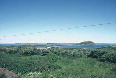
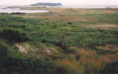
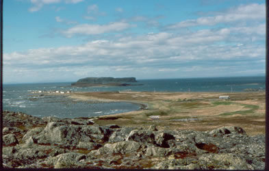
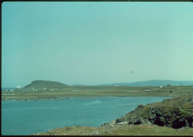
The L’Anse aux Meadows site has a magnificent view overlooking the Strait of Belle Isle and the Labrador coast but the area is exposed to strong winds and open to fierce storms that sweep in from the sea. It is an unusual spot for the Norse to settle since they normally selected more sheltered locations.
The site takes it name from the village of L’Anse aux Meadows, situated 1 km to the north on Medee Bay, a deeper bay which is separated from Epaves Bay by a low flat peninsula, Beak Point. A small flat island lies just off the point and beyond is Great Sacred Island, a high craggy basalt formation that forms a distinct landmark. Farther out in the strait is a larger island, Belle Island, noted for the strong currents changing directions around it. East of the site, Cape Bauld extends to the northwest. In windy weather it is dangerous for small boats to go around this cape to get to the eastern side of the Northern Peninsula.
Perhaps the Vikings chose the site because its location on the northern tip of Newfoundland’s Northern Peninsula makes it easy to find from any direction. If one approaches the site from the north, along the Labrador coast, it is striking. From having had land only on the starboard [right hand side] continuously all the way from Hudson Bay, this is the first time one is faced by a coastline on the port [left] side as well. If one then crosses over the Strait to this new coastline, one ends up in the L’Anse aux Meadows area.
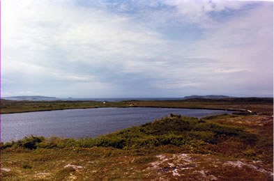
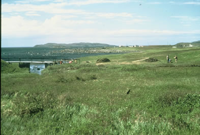
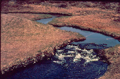
Today there are no trees on the site except bush-like clusters of tamaracks [the local names for larches], juniper bushes, and stands of dwarf birches, willows, and alders. The ground is covered with a variety of grasses and low blueberry, cranberry, and other berry bushes. Bake apples [the local name for cloudberries, a subarctic berry] grow in abundance in the raised bog. The area was not always so bare, however. Forests of Balsam fir and spruce grew just behind the site before the Basque and French began constructing seasonal fishing stations here in the 16th century. They used wood both for firewood and for the construction of their dwellings. These stations were in use until 1904. In 1835 the first permanent settlers, all of them involved in fishing, arrived on the scene, founding the present village. They needed wood for their houses and sheds, for firewood and fish flakes,’ or racks for the drying of fish. All this pushed the forest line back about 15 km. Today, when oil and vinyl siding are replacing wood for fuel and construction, trees are beginning to sprout again in pockets sheltered from the wind.
About 75% of the Norse site at L’Anse aux Meadows, including all of that is thought to be the important parts, has been excavated by archaeologists. Portions of the western bog farther away from the Norse buildings remain largely unexcavated. This is true also of the raised bog east of the site. So far there are no plans for work in these areas. In another twenty-five or fifty years, archaeological techniques will have been further refined. Therefore it is best to leave something for the future.
The excavation of the Norse site revealed not only how the Norse lived there. The techniques and scientific studies available to archaeologists also tell us what the environment was like 1000 years ago.

Journal Articles