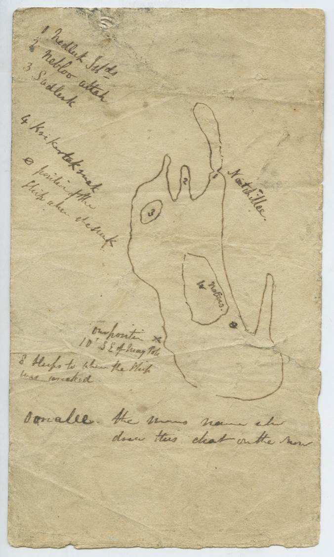
Map Drawn by Oonalee, Netsilingiut man, in 1859 showing the location where he told Captain F.L. McClintock one of Franklin's ships had sunk off Kiikertaksuak (King William Island). (1859)
| Created by: | Oonalee |
| Archive: | Royal Geographical Society, London |
| Collection: | Francis Leopold McClintock Collection |
| Reference number: | SSC-105-3 |
| Date: | 1859 |