Imperial Federation, Map of the World Showing the Extent of the British Empire in 1886 (1886)
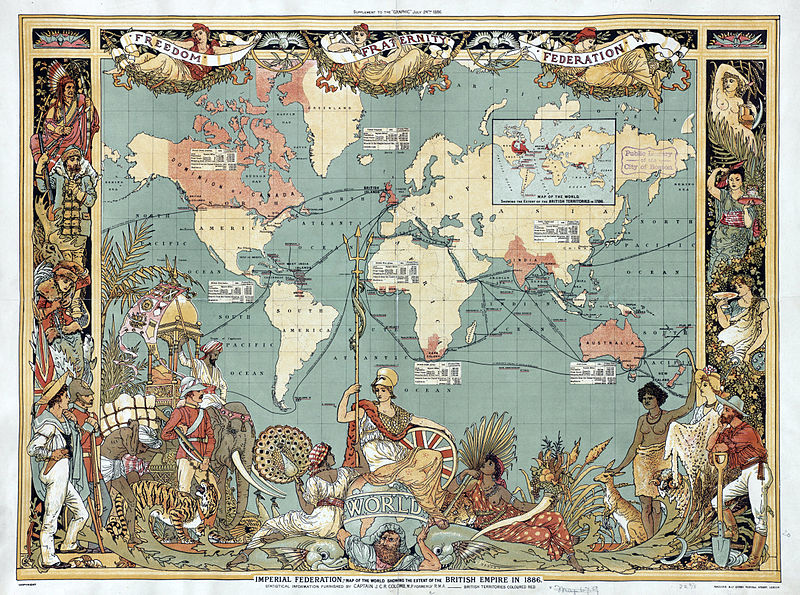
| Created by: | Walter Crane |
| Archive: | Boston Public Library, Norman B. Leventhal Map Center |
| Date: | 1886 |
| Notes: | A map of the world in 1886: areas under British control are highlighted in red. Published by Maclure and Co. |